Find Your Way. Always.
17,000+ bundled trails. Real offline maps. 3D terrain. Live fire & weather. GPS recording. Everything you need — before you lose signal.
Android 8.0+ · $5.99 · No account required
Maps That Work Offline
No signal, no worries. Trails, topo contours, roads, and points of interest are bundled into the app — ready the moment you step out of range.
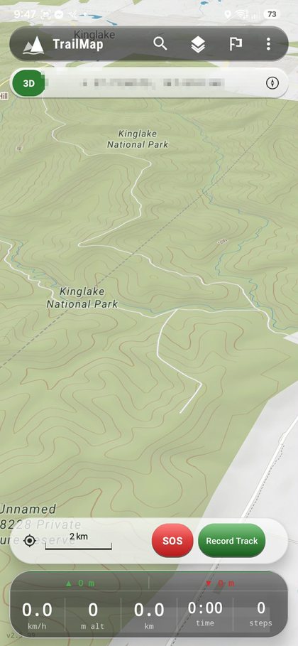
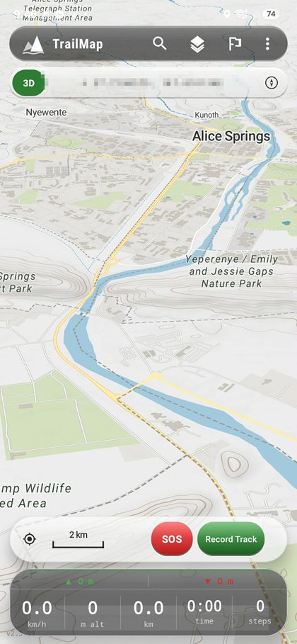
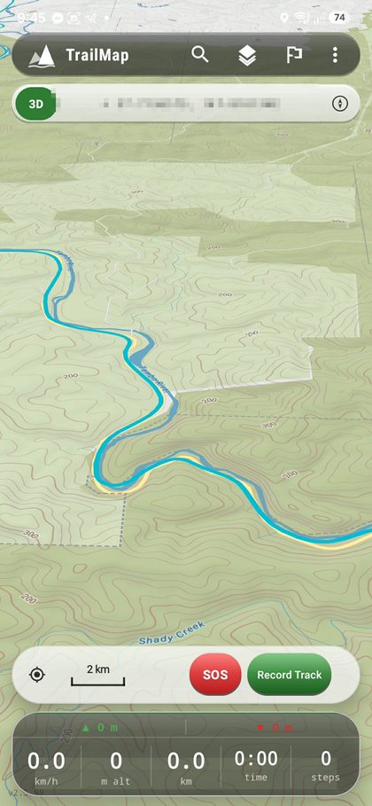
Terrain Intelligence
Tap the 3D toggle and the flat map lifts into terrain. Mountains, river valleys, gorges — the land becomes readable before you walk it.
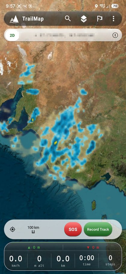
Safety First
Live bushfire alerts and radar weather — overlaid on your map, updated in real time.
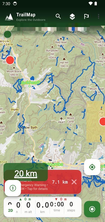
Active fire perimeters overlaid on the map as you move. Know what's burning and where, before you're in it.
Bureau of Meteorology radar, updated every 10 minutes. Watch the storm rolling in before you hear the thunder.
All Screens
Everything You Need
Walking, hiking, cycling, and 4WD tracks bundled at install. No separate download, no waiting at the trailhead.
Maps, trails, and features are fully functional without a data connection. Built for Australia's dead zones.
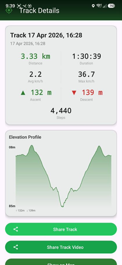
Record your route with altitude, speed, and step count. Export GPX, view elevation profiles, share your track.
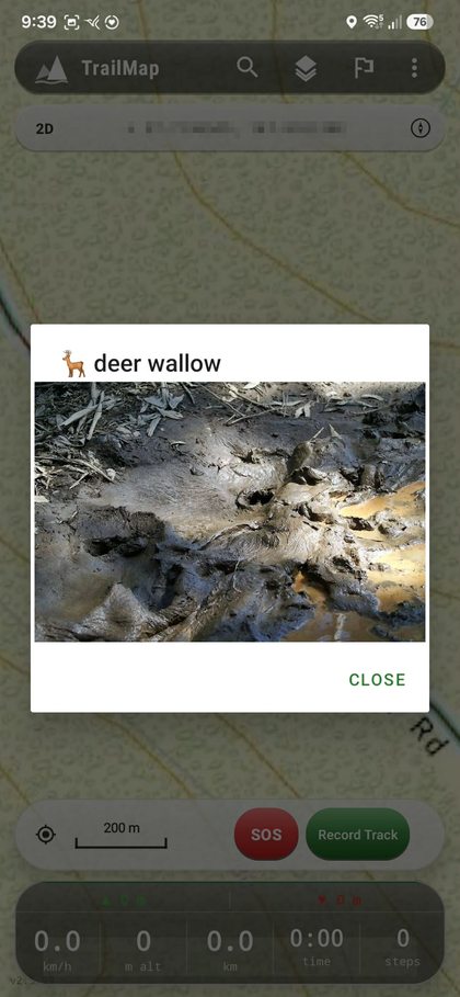
Drop a pin, add a photo, label it by category. Navigate back to any saved point with a single tap.
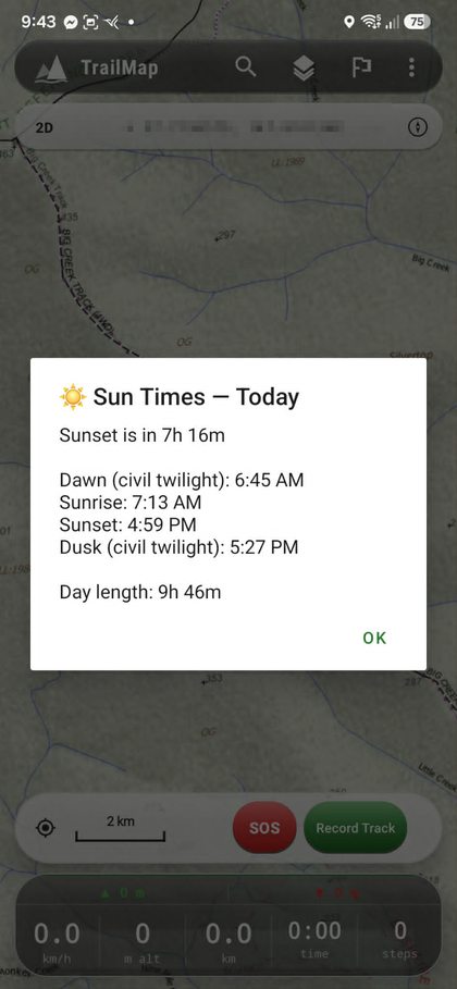
Sunrise, sunset, dawn, and dusk times for your current location. Plan your approach and exit around available light.
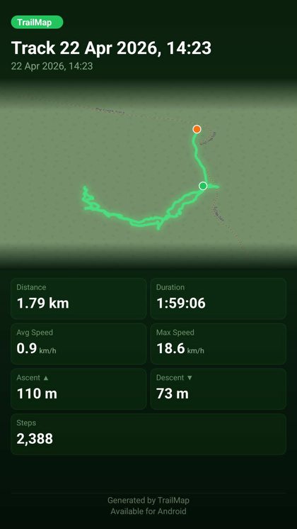
Share a track card with stats, route preview, and your branding. Export GPX to any compatible app.
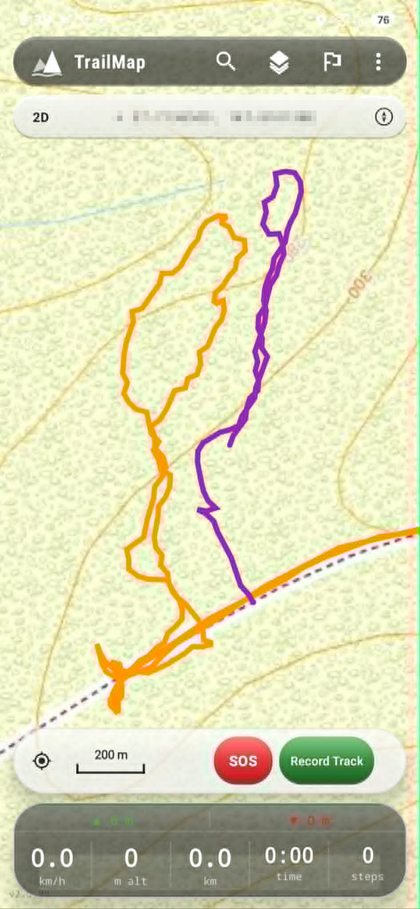
Track Recording
Start recording and TrailMap logs your path in real time — altitude, speed, distance, steps. Every track saved with a full elevation profile.
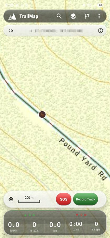
Waypoints
Long-press anywhere on the map to drop a waypoint. Add a photo, a name, a category. Every pinned spot stays with you — offline, forever.
Available now on Android. One-time purchase — no subscription, no account required.
Android 8.0+ · $5.99 · Privacy Policy · Support